| at: |
Sumter National Forest - Enoree District |
Data from USFS GIS
 show on map
 animate
Trail users:


Elevation Profile
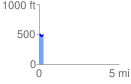
 0.250067 mi
 23.62 ft
 61.83 ft
 -38.21 ft
 4.68 %
GPX Downloads: Track Route
![]()
| at: |
Sumter National Forest - Enoree District |
show on map
animate
0.250067 mi
23.62 ft
61.83 ft
-38.21 ft
4.68 %