|
| at: |
Sumter National Forest - Enoree District |
Data from USFS GIS
 show on map
 animate
Trail users:


Elevation Profile
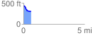
 0.607826 mi
 10.68 ft
 129.56 ft
 -118.88 ft
 4.04 %
GPX Downloads: Track Route
![]()
|
| at: |
Sumter National Forest - Enoree District |
show on map
animate
0.607826 mi
10.68 ft
129.56 ft
-118.88 ft
4.04 %