| at: |
Sumter National Forest - Enoree District |
Data from USFS GIS
 show on map
 animate
Trail users:


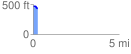
Elevation Profile
 0.293919 mi
 4.97 ft
 38.54 ft
 -33.57 ft
 2.48 %
GPX Downloads: Track Route
![]()
| at: |
Sumter National Forest - Enoree District |
show on map
animate
0.293919 mi
4.97 ft
38.54 ft
-33.57 ft
2.48 %