| at: |
Sumter National Forest - Enoree District |
Data from USFS GIS
 show on map
 animate
Trail users:


Elevation Profile
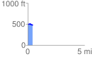
 0.439372 mi
 9.03 ft
 48.31 ft
 -39.28 ft
 2.08 %
GPX Downloads: Track Route
![]()
| at: |
Sumter National Forest - Enoree District |
show on map
animate
0.439372 mi
9.03 ft
48.31 ft
-39.28 ft
2.08 %