|
| at: |
Sumter National Forest - Enoree District |
Data from USFS GIS
 show on map
 animate
Trail users:


Elevation Profile
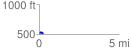
 0.283003 mi
 15.62 ft
 22.23 ft
 -6.61 ft
 1.49 %
GPX Downloads: Track Route
![]()
|
| at: |
Sumter National Forest - Enoree District |
show on map
animate
0.283003 mi
15.62 ft
22.23 ft
-6.61 ft
1.49 %