| at: |
Sumter National Forest - Enoree District |
Data from USFS GIS
 show on map
 animate
Trail users:


Elevation Profile
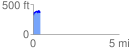
 0.402791 mi
 99.59 ft
 46.26 ft
 53.33 ft
 4.68 %
GPX Downloads: Track Route
![]()
| at: |
Sumter National Forest - Enoree District |
show on map
animate
0.402791 mi
99.59 ft
46.26 ft
53.33 ft
4.68 %