| at: |
Sumter National Forest - Enoree District |
Data from USFS GIS
 show on map
 animate
Trail users:


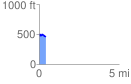
Elevation Profile
 0.404445 mi
 23.53 ft
 70.73 ft
 -47.20 ft
 3.31 %
GPX Downloads: Track Route
![]()
| at: |
Sumter National Forest - Enoree District |
show on map
animate
0.404445 mi
23.53 ft
70.73 ft
-47.20 ft
3.31 %