| at: |
Sumter National Forest - Enoree District |
Data from USFS GIS
 show on map
 animate
Trail users:


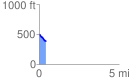
Elevation Profile
 0.416645 mi
 2.25 ft
 112.88 ft
 -110.63 ft
 5.13 %
GPX Downloads: Track Route
![]()
| at: |
Sumter National Forest - Enoree District |
show on map
animate
0.416645 mi
2.25 ft
112.88 ft
-110.63 ft
5.13 %