|
| at: |
Sumter National Forest - Enoree District |
Data from USFS GIS
 show on map
 animate
Trail users:


Elevation Profile
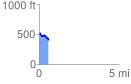
 0.581784 mi
 18.68 ft
 150.70 ft
 -132.01 ft
 4.91 %
GPX Downloads: Track Route
![]()
|
| at: |
Sumter National Forest - Enoree District |
show on map
animate
0.581784 mi
18.68 ft
150.70 ft
-132.01 ft
4.91 %