| at: |
Sumter National Forest - Enoree District |
Data from USFS GIS
 show on map
 animate
Trail users:


Elevation Profile
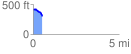
 0.545686 mi
 7.86 ft
 134.90 ft
 -127.04 ft
 4.68 %
GPX Downloads: Track Route
![]()
| at: |
Sumter National Forest - Enoree District |
show on map
animate
0.545686 mi
7.86 ft
134.90 ft
-127.04 ft
4.68 %