|
| at: |
Sumter National Forest - Enoree District |
Data from USFS GIS
 show on map
 animate
Trail users:


Elevation Profile
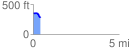
 0.431309 mi
 6.37 ft
 89.94 ft
 -83.57 ft
 3.95 %
GPX Downloads: Track Route
![]()
|
| at: |
Sumter National Forest - Enoree District |
show on map
animate
0.431309 mi
6.37 ft
89.94 ft
-83.57 ft
3.95 %