| at: |
Sumter National Forest - Enoree District |
Data from USFS GIS
 show on map
 animate
Trail users:


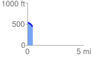
Elevation Profile
 0.457493 mi
 10.73 ft
 84.82 ft
 -74.09 ft
 3.51 %
GPX Downloads: Track Route
![]()
| at: |
Sumter National Forest - Enoree District |
show on map
animate
0.457493 mi
10.73 ft
84.82 ft
-74.09 ft
3.51 %