| at: |
Francis Marion National Forest |
Data from USFS GIS
 show on map
 animate
Trail users:


Elevation Profile
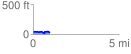
 0.986910 mi
 78.91 ft
 112.05 ft
 -33.13 ft
 2.15 %
GPX Downloads: Track Route
![]()
| at: |
Francis Marion National Forest |
show on map
animate
0.986910 mi
78.91 ft
112.05 ft
-33.13 ft
2.15 %