|
| at: |
Francis Marion National Forest |
Data from USFS GIS
 show on map
 animate
Trail users:


Elevation Profile
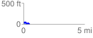
 0.540876 mi
 74.89 ft
 87.08 ft
 -12.19 ft
 3.05 %
GPX Downloads: Track Route
![]()
|
| at: |
Francis Marion National Forest |
show on map
animate
0.540876 mi
74.89 ft
87.08 ft
-12.19 ft
3.05 %