|
| at: |
Francis Marion National Forest |
Data from USFS GIS
 show on map
 animate
Trail users:


Elevation Profile
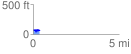
 0.367998 mi
 64.85 ft
 60.59 ft
 4.26 ft
 3.34 %
GPX Downloads: Track Route
![]()
|
| at: |
Francis Marion National Forest |
show on map
animate
0.367998 mi
64.85 ft
60.59 ft
4.26 ft
3.34 %