|
| at: |
Francis Marion National Forest |
Data from USFS GIS
 show on map
 animate
Trail users:


Elevation Profile
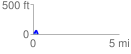
 0.292444 mi
 54.46 ft
 49.52 ft
 4.94 ft
 3.53 %
GPX Downloads: Track Route
![]()
|
| at: |
Francis Marion National Forest |
show on map
animate
0.292444 mi
54.46 ft
49.52 ft
4.94 ft
3.53 %