|
| at: |
Francis Marion National Forest |
Data from USFS GIS
 show on map
 animate
Trail users:


Elevation Profile
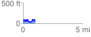
 1.012254 mi
 177.28 ft
 176.80 ft
 0.48 ft
 3.32 %
GPX Downloads: Track Route
![]()
|
| at: |
Francis Marion National Forest |
show on map
animate
1.012254 mi
177.28 ft
176.80 ft
0.48 ft
3.32 %