|
| at: |
Francis Marion National Forest |
Data from USFS GIS
 show on map
 animate
Trail users:


Elevation Profile
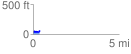
 0.392164 mi
 70.61 ft
 44.65 ft
 25.96 ft
 3.41 %
GPX Downloads: Track Route
![]()
|
| at: |
Francis Marion National Forest |
show on map
animate
0.392164 mi
70.61 ft
44.65 ft
25.96 ft
3.41 %