| at: |
Francis Marion National Forest Battery Warren |
Data from USFS GIS
 show on map
 animate
Trail users:

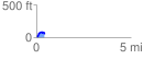
Elevation Profile
 0.447293 mi
 89.94 ft
 60.97 ft
 28.97 ft
 3.81 %
GPX Downloads: Track Route
Trailheads:
 Battery Warren Parking Area