| at: |
Sumter National Forest - Andrew Pickens District Rocky Gap Horse Trail |
Data from USFS GIS
 show on map
 animate
Trail users:


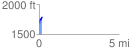
Elevation Profile
 0.182157 mi
 123.12 ft
 11.17 ft
 111.94 ft
 12.80 %
GPX Downloads: Track Route
Trailheads:
 Whetstone Horse Camp