| at: |
Francis Marion National Forest Sewee Shell Ring |
Data from USFS GIS
 show on map
 animate
Trail users:

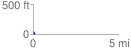
Elevation Profile
 0.102239 mi
 1.87 ft
 44.25 ft
 -42.38 ft
 8.20 %
GPX Downloads: Track Route
![]()
| at: |
Francis Marion National Forest Sewee Shell Ring |
show on map
animate
0.102239 mi
1.87 ft
44.25 ft
-42.38 ft
8.20 %