| at: |
Sumter National Forest - Long Cane District Parsons Mountain Lake Recreation Area |
Data from USFS GIS
 show on map
 animate
Trail users:

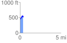
Elevation Profile
 0.380585 mi
 193.25 ft
 102.11 ft
 91.15 ft
 9.62 %
GPX Downloads: Track Route
Trailheads:
 Parsons Mountain Lake