| at: |
Sumter National Forest - Long Cane District Parsons Mountain Lake Recreation Area |
Data from USFS GIS
 show on map
 animate
Trail users:


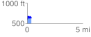
Elevation Profile
 0.376630 mi
 121.29 ft
 162.13 ft
 -40.84 ft
 8.15 %
GPX Downloads: Track Route
Trailheads:
 Parsons Mountain OHV Trailhead