| at: |
Bonnet Carre Spillway |
Data from David Muse
 show on map
 animate
Trail users:


Elevation Profile
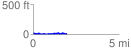
 1.966921 mi
 93.51 ft
 90.88 ft
 2.62 ft
 0.90 %
GPX Downloads: Track Route
![]()
| at: |
Bonnet Carre Spillway |
show on map
animate
1.966921 mi
93.51 ft
90.88 ft
2.62 ft
0.90 %