| at: |
Whittier Mill Park |
Data from David Muse
 show on map
 animate
Trail users:

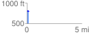
Elevation Profile
 0.137287 mi
 24.28 ft
 12.47 ft
 11.81 ft
 3.35 %
GPX Downloads: Track Route
![]()
| at: |
Whittier Mill Park |
show on map
animate
0.137287 mi
24.28 ft
12.47 ft
11.81 ft
3.35 %