| at: |
Whittier Mill Park |
Data from David Muse
 show on map
 animate
Trail users:

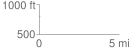
Elevation Profile
 0.022708 mi
 8.86 ft
 0.00 ft
 8.86 ft
 7.39 %
GPX Downloads: Track Route
![]()
| at: |
Whittier Mill Park |
show on map
animate
0.022708 mi
8.86 ft
0.00 ft
8.86 ft
7.39 %