| at: |
Davidson River Area |
Data from David Muse
 show on map
 animate
Trail users:


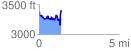
Elevation Profile
 1.383949 mi
 424.96 ft
 411.86 ft
 13.10 ft
 5.82 %
GPX Downloads: Track Route
![]()
| at: |
Davidson River Area |
show on map
animate
1.383949 mi
424.96 ft
411.86 ft
13.10 ft
5.82 %