| at: |
Burnt Mountain |
Data from David Muse
 show on map
 animate
Trail users:


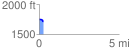
Elevation Profile
 0.268226 mi
 12.40 ft
 46.78 ft
 -34.38 ft
 3.30 %
GPX Downloads: Track Route
![]()
| at: |
Burnt Mountain |
show on map
animate
0.268226 mi
12.40 ft
46.78 ft
-34.38 ft
3.30 %