| at: |
Burnt Mountain |
Data from David Muse
 show on map
 animate
Trail users:


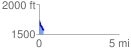
Elevation Profile
 0.299145 mi
 0.00 ft
 169.55 ft
 -169.55 ft
 10.73 %
GPX Downloads: Track Route
![]()
| at: |
Burnt Mountain |
show on map
animate
0.299145 mi
0.00 ft
169.55 ft
-169.55 ft
10.73 %