| at: |
Paynes Creek Recreation Area |
Data from David Muse
 show on map
 animate
Trail users:


Elevation Profile
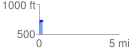
 0.224056 mi
 49.74 ft
 21.10 ft
 28.64 ft
 4.20 %
GPX Downloads: Track Route
![]()
| at: |
Paynes Creek Recreation Area |
show on map
animate
0.224056 mi
49.74 ft
21.10 ft
28.64 ft
4.20 %