| at: |
Serenbe |
Data from David Muse
 show on map
 animate
Trail users:


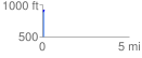
Elevation Profile
 0.119679 mi
 30.41 ft
 2.89 ft
 27.53 ft
 4.81 %
GPX Downloads: Track Route
![]()
| at: |
Serenbe |
show on map
animate
0.119679 mi
30.41 ft
2.89 ft
27.53 ft
4.81 %