| at: |
Serenbe |
Data from David Muse
 show on map
 animate
Trail users:
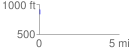
Elevation Profile
 0.023779 mi
 76.15 ft
 76.31 ft
 -0.16 ft
 60.78 %
GPX Downloads: Track Route
![]()
| at: |
Serenbe |
show on map
animate
0.023779 mi
76.15 ft
76.31 ft
-0.16 ft
60.78 %