| at: |
Serenbe |
Data from David Muse
 show on map
 animate
Trail users:


Elevation Profile
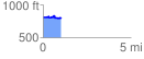
 1.047332 mi
 89.11 ft
 106.63 ft
 -17.52 ft
 1.93 %
GPX Downloads: Track Route
![]()
| at: |
Serenbe |
show on map
animate
1.047332 mi
89.11 ft
106.63 ft
-17.52 ft
1.93 %