| at: |
Chisenhall Fields |
Data from David Muse
 show on map
 animate
Trail users:


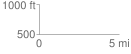
Elevation Profile
 0.023108 mi
 0.30 ft
 0.36 ft
 -0.07 ft
 0.30 %
GPX Downloads: Track Route
![]()
| at: |
Chisenhall Fields |
show on map
animate
0.023108 mi
0.30 ft
0.36 ft
-0.07 ft
0.30 %