| at: |
Dawson Forest |
Data from David Muse
 show on map
 animate
Trail users:


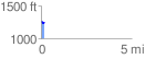
Elevation Profile
 0.186585 mi
 2.18 ft
 29.13 ft
 -26.96 ft
 2.96 %
GPX Downloads: Track Route
![]()
| at: |
Dawson Forest |
show on map
animate
0.186585 mi
2.18 ft
29.13 ft
-26.96 ft
2.96 %