|
| at: |
Lake Russell WMA |
Data from Positive Flow
 show on map
 animate
Trail users:


Elevation Profile
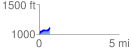
 0.672624 mi
 139.73 ft
 33.10 ft
 106.62 ft
 3.93 %
GPX Downloads: Track Route
![]()
|
| at: |
Lake Russell WMA |
show on map
animate
0.672624 mi
139.73 ft
33.10 ft
106.62 ft
3.93 %