|
| at: |
Windy Gap |
Data from David Muse
 show on map
 animate
Trail users:


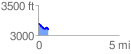
Elevation Profile
 0.632046 mi
 29.09 ft
 128.26 ft
 -99.17 ft
 3.84 %
GPX Downloads: Track Route
![]()
|
| at: |
Windy Gap |
show on map
animate
0.632046 mi
29.09 ft
128.26 ft
-99.17 ft
3.84 %