|
| at: |
South Oconee National Forest |
Data from David Muse
 show on map
 animate
Trail users:


Elevation Profile
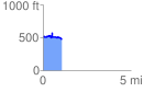
 1.091590 mi
 104.87 ft
 148.04 ft
 -43.17 ft
 2.57 %
GPX Downloads: Track Route
![]()
|
| at: |
South Oconee National Forest |
show on map
animate
1.091590 mi
104.87 ft
148.04 ft
-43.17 ft
2.57 %