|
| at: |
Tray Mountain |
Data from David Muse
 show on map
 animate
Trail users:


Elevation Profile
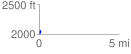
 0.150995 mi
 69.38 ft
 36.04 ft
 33.34 ft
 8.70 %
GPX Downloads: Track Route
![]()
|
| at: |
Tray Mountain |
show on map
animate
0.150995 mi
69.38 ft
36.04 ft
33.34 ft
8.70 %