| at: |
Clark Creek Natural Area |
Data from David Muse
 show on map
 animate
Trail users:

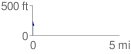
Elevation Profile
 0.086613 mi
 0.00 ft
 75.43 ft
 -75.43 ft
 16.49 %
GPX Downloads: Track Route
![]()
| at: |
Clark Creek Natural Area |
show on map
animate
0.086613 mi
0.00 ft
75.43 ft
-75.43 ft
16.49 %