|
| at: |
North Oconee National Forest |
Data from David Muse
 show on map
 animate
Trail users:


Elevation Profile
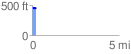
 0.226350 mi
 20.69 ft
 17.50 ft
 3.20 ft
 1.73 %
GPX Downloads: Track Route
![]()
|
| at: |
North Oconee National Forest |
show on map
animate
0.226350 mi
20.69 ft
17.50 ft
3.20 ft
1.73 %