|
| at: |
Coleman River Scenic Area |
Data from David Muse
 show on map
 animate
Trail users:


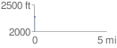
Elevation Profile
 0.089039 mi
 0.60 ft
 20.86 ft
 -20.26 ft
 4.44 %
GPX Downloads: Track Route
![]()
|
| at: |
Coleman River Scenic Area |
show on map
animate
0.089039 mi
0.60 ft
20.86 ft
-20.26 ft
4.44 %