|
| at: |
Sandy Ford |
Data from David Muse
 show on map
 animate
Trail users:


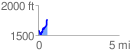
Elevation Profile
 0.597068 mi
 266.65 ft
 87.06 ft
 179.59 ft
 8.46 %
GPX Downloads: Track Route
![]()
|
| at: |
Sandy Ford |
show on map
animate
0.597068 mi
266.65 ft
87.06 ft
179.59 ft
8.46 %