|
| at: |
South Oconee National Forest |
Data from David Muse
 show on map
 animate
Trail users:


Elevation Profile
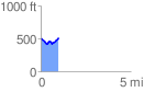
 0.984073 mi
 148.35 ft
 133.46 ft
 14.89 ft
 2.86 %
GPX Downloads: Track Route
![]()
|
| at: |
South Oconee National Forest |
show on map
animate
0.984073 mi
148.35 ft
133.46 ft
14.89 ft
2.86 %