| at: |
Fort Ord Public Lands |
Data from David Muse
 show on map
 animate
Trail users:


Elevation Profile
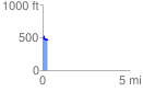
 0.285087 mi
 40.18 ft
 97.35 ft
 -57.16 ft
 6.47 %
GPX Downloads: Track Route
![]()
| at: |
Fort Ord Public Lands |
show on map
animate
0.285087 mi
40.18 ft
97.35 ft
-57.16 ft
6.47 %