| at: |
Fort Ord Public Lands |
Data from David Muse
 show on map
 animate
Trail users:


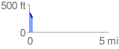
Elevation Profile
 0.212081 mi
 11.27 ft
 73.58 ft
 -62.31 ft
 6.57 %
GPX Downloads: Track Route
![]()
| at: |
Fort Ord Public Lands |
show on map
animate
0.212081 mi
11.27 ft
73.58 ft
-62.31 ft
6.57 %