| at: |
Fort Ord Public Lands |
Data from David Muse
 show on map
 animate
Trail users:


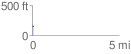
Elevation Profile
 0.068968 mi
 12.34 ft
 3.98 ft
 8.36 ft
 3.39 %
GPX Downloads: Track Route
![]()
| at: |
Fort Ord Public Lands |
show on map
animate
0.068968 mi
12.34 ft
3.98 ft
8.36 ft
3.39 %