| at: |
Fort Ord Public Lands |
Data from David Muse
 show on map
 animate
Trail users:


Elevation Profile
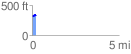
 0.238402 mi
 36.50 ft
 38.87 ft
 -2.37 ft
 3.09 %
GPX Downloads: Track Route
![]()
| at: |
Fort Ord Public Lands |
show on map
animate
0.238402 mi
36.50 ft
38.87 ft
-2.37 ft
3.09 %