| at: |
Frank G. Bonelli Regional Park |
Data from Jason Sager
 show on map
 animate
Trail users:


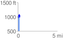
Elevation Profile
 0.239946 mi
 199.00 ft
 110.32 ft
 88.68 ft
 15.71 %
GPX Downloads: Track Route
![]()
| at: |
Frank G. Bonelli Regional Park |
show on map
animate
0.239946 mi
199.00 ft
110.32 ft
88.68 ft
15.71 %