| at: |
Ashland Watershed |
Data from David Muse
 show on map
 animate
Trail users:


Elevation Profile
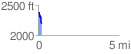
 0.224166 mi
 18.29 ft
 205.89 ft
 -187.61 ft
 17.40 %
GPX Downloads: Track Route
![]()
| at: |
Ashland Watershed |
show on map
animate
0.224166 mi
18.29 ft
205.89 ft
-187.61 ft
17.40 %